Create area around a geopoint
This processor creates buffer polygons around geopoints. For each input geospatial point, a spatial polygon is created around it, delimiting the area of influence covered by the point (all the points that fall within a given distance from the geopoint). The shape area of the polygon can be either rectangular or circular (using an approximation) and the size will depend on the selected parameters.
Action
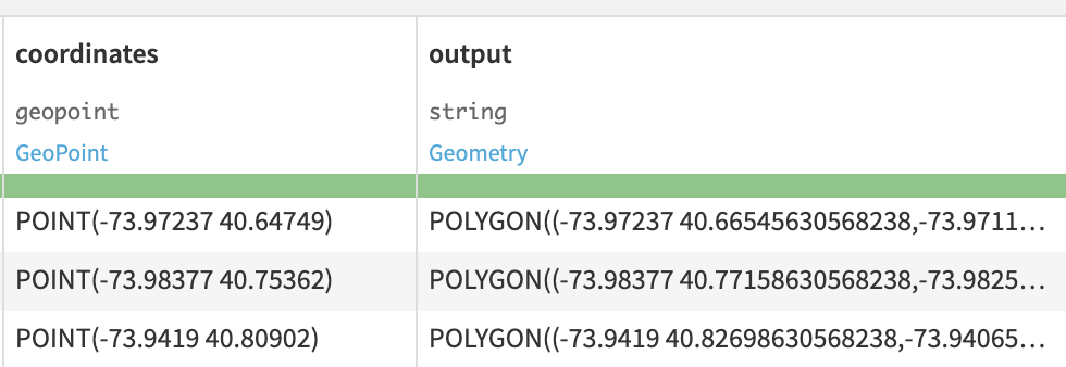
You can select an input column that contains geopoints on which the polygon is centered. The output column will contain created polygons in the WKT format.
Polygon creation options
Select the shape of polygons from:
Rectangular
Circular
Select the unit of distances from:
Kilometers
Miles
If Rectangle shape is selected:
Select the Width and Height of the Rectangle shape to compute.
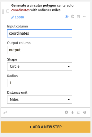
If Circle shape is selected:
Select the Radius of the Circle shape to compute.
Each distance is expressed according to the input unit.
Screenshots
Explore view of input and output columns:
Parameters of the processor:
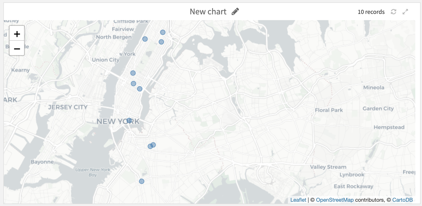
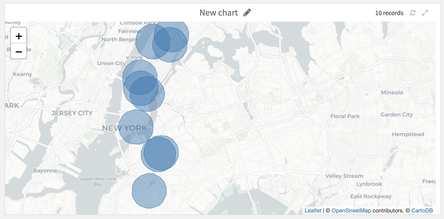
Input and associated output on a map (Circular shape):